
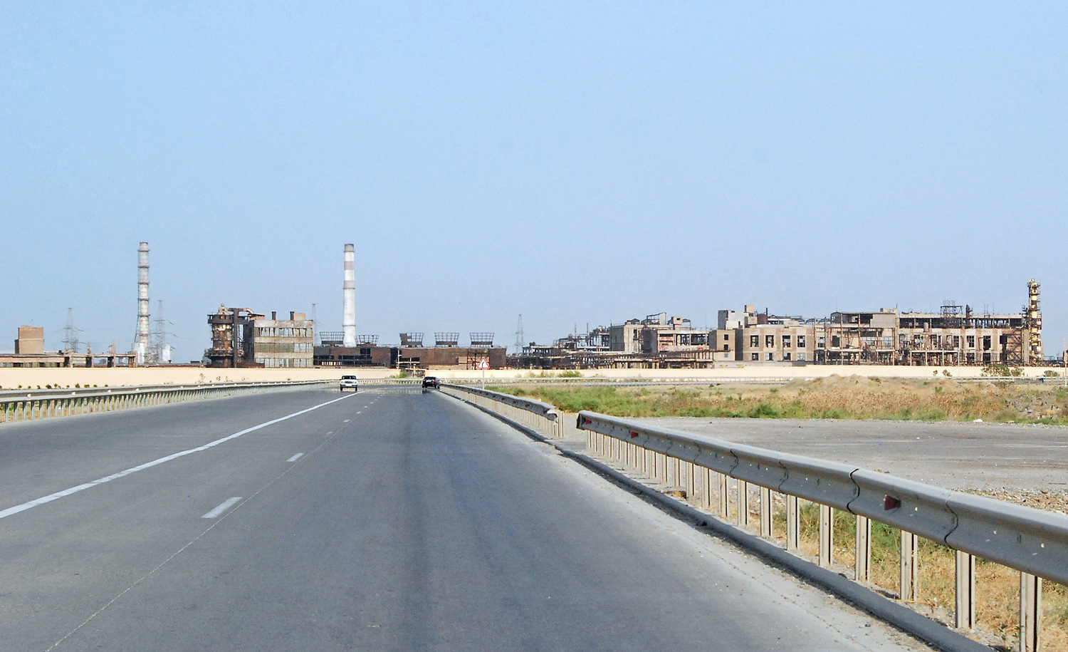
In today’s installment, we’re leaving Baku and heading to the mountainous region of Quba. But before we get there, we’ll have a look at the quintessential post-Soviet landscape on the road outside the capital, near Sumqayit. Here’s how the Traiblazer Azerbaijan Guide describes Sumqayit:
“Until 1940 Sumqayit was a village of 4,000 souls set on an idyllic curve of white sandy beach. It might have been developed into the coutnry’s foremost resort. But Soviet planners had a better idea: a concrete tower city of 250,000 people and as many rusty pipes. By the 1980’s it was home to 80% of Azerbaijan’s heavy industry, a brave new world of chemical factories that belched colourful fumes so acrid that locals passing through by train found their white clothes stained yellow!” [There might be a bit of Caucasian exaggeration here.]
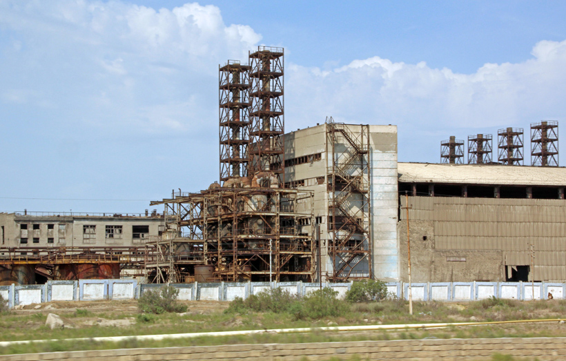
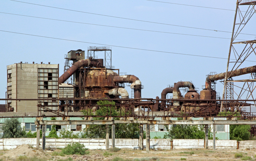
Now that most if not all factories have closed, there remains a photogenic dilapidated mess of funky buildings and equipment. I’m no specialist of factory design, but where else do you see such massive group installations like this one, outside of the post-Soviet space?
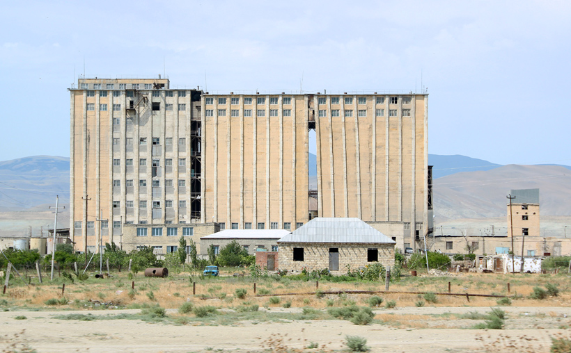
And what’s the story of this funny building? Why are there windows only on the top floors, and a gap in the middle? Is it supposed to look like it’s collapsing by design? Someone must have noticed that those vertical white lines weren’t all that vertical when they were making them, no?
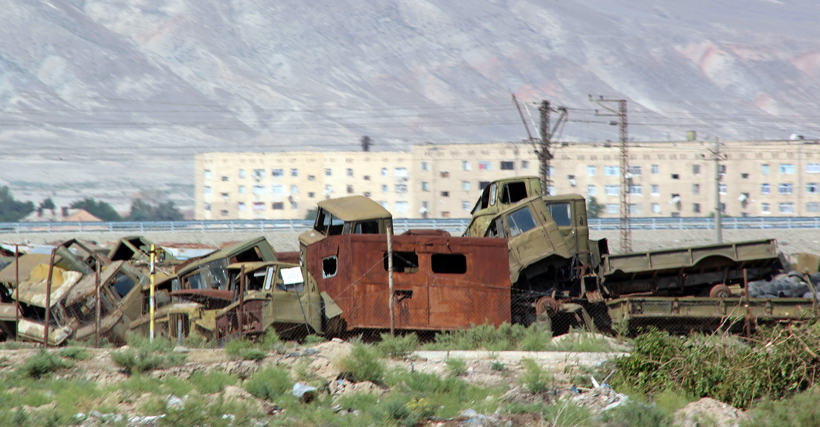
A truck cemetery nearby completes this picture of desolation:
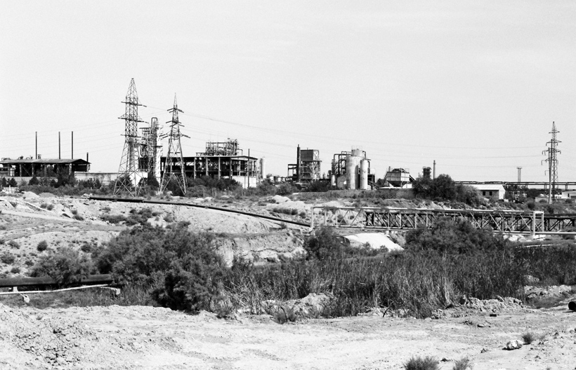
The same factories, shot by William Oger in black-and-white:
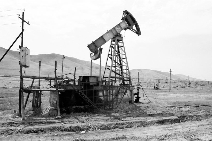
A little bit further on the road, we hit a small derrick field. The old oil derrick is such a fixture in Azerbaijan’s landscape that it deserves a separate post (coming soon).
There are many other abandoned factories in the country, especially in the South and the central region, but they’re further away from the touristy track — insofar as you can talk of tourism when the only other foreigners I’ve seen were there on business trips.
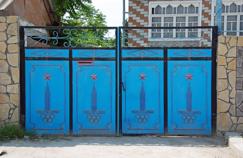
There are also, however, other Soviet relics that a trained eye will notice. Such as this residential gate sporting the logo of the 1980 Summer Olympics in Moscow:
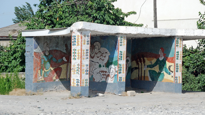
And of course, the bus stops. As per usual in the Caucasus (and everywhere else, really), the locals are pictured living a simple life. In Georgia, people indulged in music, wine, and food. In Azerbaijan, proud men in traditional costumes ride their horses and and hunt game with recurve bows:
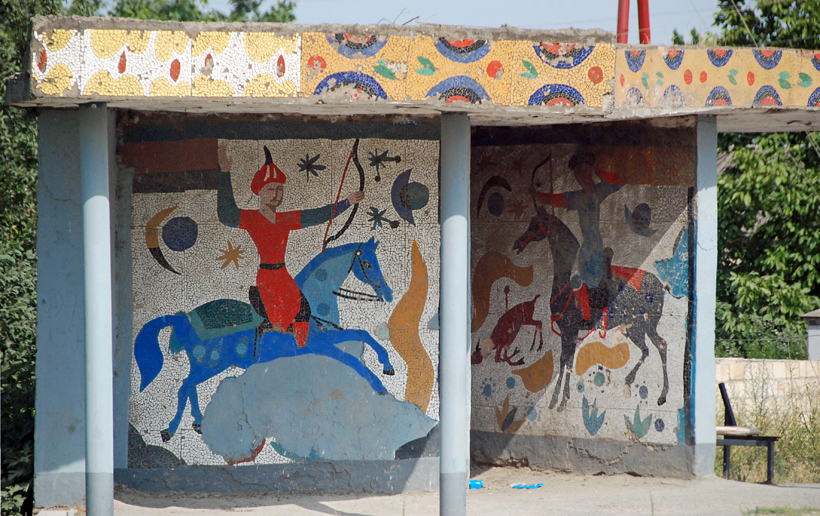
Others watch their flocks or harvest their fields. Makes it seem a bit like Azeris are hard-working, while Georgians just like to feast and party!
Of course, the “new” regime, led first by the same former communist boss who used to be the head of the KGB and the country, and then by his son, added its own marks to the landscape, in the form of various billboards in every town and on every road. One classic version represents the patriarch Heydar Aliyev alone (see my Azerbaijan Adventures, Part 2 for a short bio), and the other shows father and son Ilham in deep discussion, the son absorbing the lessons of a man who ruled Azerbaijan in various functions over 30 years. Note to sonny: when daddy’s billboards start fading, they should be refreshed to keep inspiring respect in the populace.


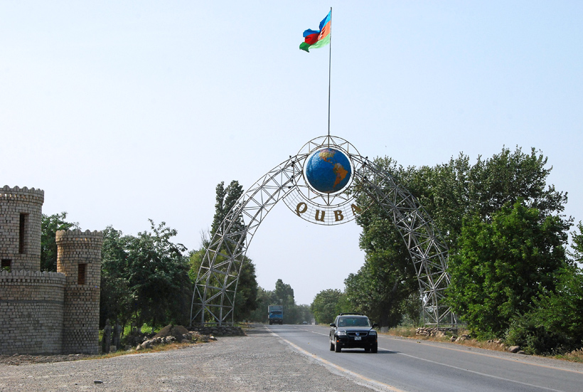
Finally, we’re now entering the region of Quba, whose singular location between the mountains and the sea is, as we’ll see next time, well-suited for growing produce.
6 comments
Nice photos! Cheers!
Thanks, Alex!
You are welcome!!
Although, I must say, you seem to be a much better photographer than me!
Thank you! But you will have nice photos eventually!